
Navigation built for drivers
Turn-by-turn with live traffic, police, hazard, camera and police-aircraft alerts, group drives with your friends — and the shops, tracks, drives and car events around you, right on the map. Get it inside Stradena with every car event that matters, or on its own as Stradnav.
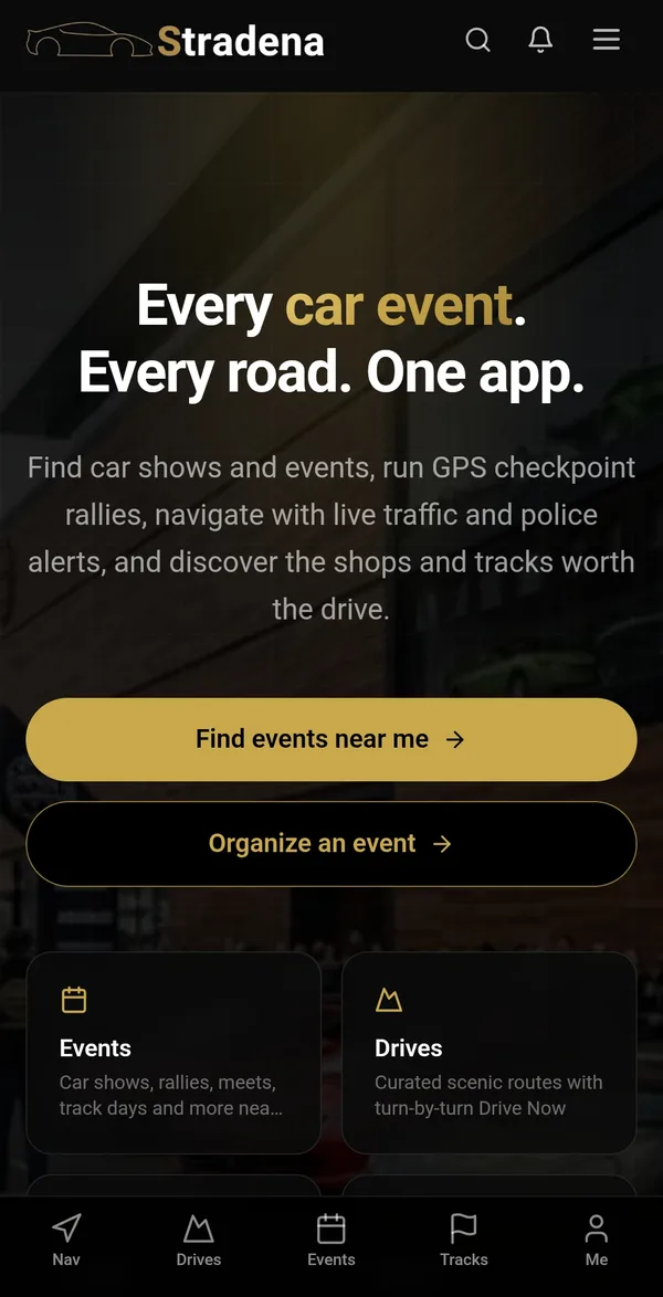
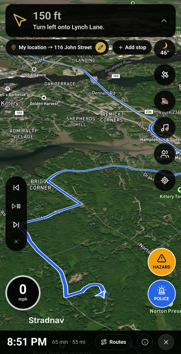
Two apps. One account.
Same Nav in both. Pick how much car culture you want with it.
Stradena
Everything — with Nav built in.
The whole car scene in one app: shows and meets near you, GPS checkpoint rallies, curated scenic drives, clubs, shops and tracks — plus the full navigator.
Stradnav
Just the navigation. No extras.
Stradena's navigator on its own: open it, say where you're going, drive. No events, no feeds — just the map, the alerts and your friends.
| Feature | Stradena | Stradnav |
|---|---|---|
| Turn-by-turn navigation & live traffic | ||
| Police, hazard & speed-camera alerts | ||
| Police aircraft alerts | ||
| Shops, tracks, drives & today's events on the map | ||
| Group drives & group chat | ||
| Android Auto | ||
| Car shows, meets & track days | ||
| GPS checkpoint rallies | ||
| Scenic drives | ||
| Clubs, shops, tracks & car videos |
Know when there's a police aircraft overhead
State police and highway patrols in several states time traffic from the air — then radio ahead to a trooper on the ground. Stradena and Stradnav watch more than 1,000 US law-enforcement planes and helicopters and let you know when one is flying low near you.
- State police and highway patrol air units nationwide, plus sheriffs and city police
- A plane or helicopter marker on your map, live
- A spoken heads-up when one is within about 3 miles and flying low
- Free — included with speed-camera, police and hazard alerts
Based on public aircraft position data and the FAA aircraft registry. Not every police aircraft broadcasts its position — drive safely and follow posted limits.
Example alerts
Example pins
The good stuff, right on your map
Nav now shows the car spots around you from Stradena — so you find the cars & coffee happening this morning, the twisty road two exits away, or a track you didn't know was close.
- Shops, race tracks, scenic drives and car events happening today — each with its own pin
- Tap a pin to navigate there, start a scenic drive with every stop, or add it to your trip
- While you're navigating, only places near your route — kept small so they never get in the way
- Switch each kind on or off in Map layers
Everything in Nav
In Stradnav, and built into Stradena.
Turn-by-turn with live traffic
Spoken directions, a clear turn banner you can shrink, and a route that changes color with traffic — blue when it's flowing, yellow when it slows, red when it's jammed. Reroutes on its own if you miss a turn.
Up to three routes
Tap Routes to see your options side by side on the map, each in its own color with the time difference — fastest, no highways or no tolls. Pick one and Nav keeps you on it.
Police & hazard reports
One tap reports police or a hazard for every driver nearby. You'll hear about reports ahead of you, and can confirm “still there” or “gone” as you pass.
Police aircraft alerts
NEWLive positions of more than 1,000 US state police, highway patrol, sheriff and city police planes and helicopters. When one is flying low within a few miles, you'll get a heads-up.
Speed & red-light cameras
NEWFixed speed and red-light cameras across the US, with an alert as you approach one on your route — and the enforced limit when it's known.
Car spots on the map
NEWShops, race tracks, scenic drives and car events happening today show up as pins as you get close. Tap one to navigate there, start the drive or add it as a stop — and switch each kind on or off in Map layers.
Group drives
Start a group, share a link or 6-letter code, and see your friends live on the map with a group chat — perfect for cruises, convoys and rallies.
Speed & speed limit
Your speed next to the posted limit, highlighted in red when you're over.
Weather on the way
Current conditions at a glance, and a warning when rain is ahead on your route.
Music & police scanner
Open Spotify, Apple Music, Amazon Music or Pandora and control playback without leaving the map — or listen to local police scanners through Broadcastify.
Satellite or dark map
Switch between satellite imagery and a dark map made for night driving. Multi-stop trips, favorites and recent places are one tap away.
On your car's screen
Android Auto support, so your favorites and car events show up on the dashboard.
Report a problem
Wrong turn, bad alert or a bug? Report it from the map in a few taps — it reaches our team with everything we need to fix it.
Plus the whole car scene in Stradena
Everything above, and the reasons to go for a drive.
Every car event
Car shows, cars & coffee, meets, track days and rallies near you — RSVP, save and drive there in one tap.
GPS checkpoint rallies
Join rallies with live check-ins and standings — or organize your own with route tools and a live map of every driver.
Curated scenic drives
Hand-picked driving roads with Drive Now — the route loads straight into Nav.
Clubs & community
Join car clubs, follow organizers and keep up with the people you drive with.
Shops & tracks
Find tuners, detailers and race tracks worth the trip, with reviews and directions.
Car videos
The best car channels and videos in one place.
Questions
Are the apps free?+
Yes. Stradena and Stradnav are free to download and use, including every alert listed on this page.
Which app should I get?+
If you love the car scene — events, rallies, drives, clubs — get Stradena; its Nav is the same as Stradnav's. If you only want a great navigator, get Stradnav. You can switch any time.
Do I need two accounts?+
No. Both apps use the same Stradena account, so your favorites, group drives and settings follow you.
Is it on iPhone?+
Both apps are coming to Google Play first. iPhone is next — sign up now and we'll let you know.
How do police aircraft alerts work?+
Most aircraft broadcast their position publicly. We watch a list of more than 1,000 US law-enforcement planes and helicopters from the FAA registry and alert you when one is flying low nearby. Not every police aircraft broadcasts its position, so treat it as a helpful heads-up — not a guarantee.
Where do the camera locations come from?+
From OpenStreetMap, the community-built world map. Coverage is excellent in some areas and patchy in others — mobile and school-zone cameras usually aren't included.
What are the pins on the map?+
They're places from Stradena: car shops (blue wrench), race tracks (red flag), scenic drives (gold road, pinned where the drive starts) and car events happening today (purple car). While you're navigating, only the ones close to your route are shown. Open Map layers to switch any of them off.
Is it safe to use while driving?+
Set your destination before you go and keep the phone mounted. Nav is designed to be heard, not handled — and anything you type should be done by a passenger.
Be first on the road
Create your free Stradena account now — it works in both apps the day they launch.
Passenger use only — don't operate your phone while driving. Scanner audio is provided by Broadcastify.