
Wood Buffalo Route: Hay River to Fort Smith and Wood Buffalo National Park
Hay River, Northwest Territories · Shared by Nate R.
Something wrong with this trip? Sign in to report it.
Route
6 stops- S
Hay River
Starting point
- 1
Fort Resolution
- 2
Little Buffalo Falls Territorial Park
- 3
Queen Elizabeth Territorial Park
- 4
Fort Smith
- 5
Pine Lake
- 6
Fort Fitzgerald
About this trip
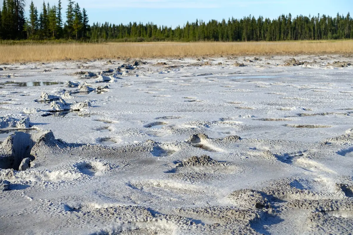
This route heads east from Hay River on paved Highway 5 into Wood Buffalo National Park, the largest national park in North America, a UNESCO World Heritage Site and the world's largest Dark Sky Preserve. It ends at Fort Smith on the thundering Slave River rapids. Expect free-roaming bison, karst sinkholes, salt flats and turquoise sinkhole lakes. Day 1: Start with a detour up Highway 6 to Fort Resolution on Great Slave Lake, the oldest documented European community in the NWT (1819). Return to Highway 5 and stop at the Angus sinkhole lookout (km 107) and the Nyarling River, which runs underground. Camp at Little Buffalo Falls Territorial Park beside its small waterfall and gorge. Day 2: Take the 13 km side road from km 230 to the Salt Plains Overlook, then walk down to the salt flats, barefoot as the park asks. Watch the white pelicans, the northernmost colony in the world, at the Slave River rapids from Queen Elizabeth Territorial Park, then explore Fort Smith and the park visitor centre. Day 3: Drive south on gravel Pine Lake Road watching for bison and wolves. Picnic at the Salt River Day Use Area, hike to the white, boulder-strewn Grosbeak Lake, and camp at the aquamarine Pine Lake. Day 4: Return through Fort Smith and finish at historic Fort Fitzgerald just across the Alberta line, the far end of the old portage around the four impassable rapids. Suggested overnights Day 1: overnight in Little Buffalo Falls Territorial Park Day 2: overnight in Fort Smith Day 3: overnight in Pine Lake Best time to go: June to early September. Pine Lake campground runs from the May long weekend to September 30. Pine Lake is ice-free from mid to late June and warm enough to swim from July to early September. Late August to April is best for dark skies and aurora, including the late-August Dark Sky Festival. Good to know • Highway 5 to Fort Smith is paved. Pine Lake Road is gravel. The Salt Plains access road is gravel and not recommended for trailers. Parsons Lake Road and Hay Camp Road are dirt (AWD or 4x4 for Parsons Lake, and no trailers on either). • Distances between services are long. Fill up in Hay River and Fort Smith. • Bison often stand on or near the road. Slow down and give them space. • Pack strong bug repellent for June and July blackflies and mosquitoes. There is no cell service at Pine Lake. • Parks Canada runs free guided programs in summer: Salt Plains walks on Tuesdays, Grosbeak Lake hikes on Thursdays and paddling at Pine Lake on Saturdays. Check current schedules. Photo: Melinaguene / CC BY-SA 4.0 / Wikimedia Commons
Tips & questions (0)
Been on this trip, or have a question? Start the conversation.
Sign up free to ask a question or share a tip.
Planning a trip of your own?
Map your stops, share the plan with family and friends, and drive it with Stradena Nav. When you're back, post it publicly so others can enjoy it too.