
Lake Tahoe West Shore & Emerald Bay (CA-89)
Granite cliffs above one of America's clearest alpine lakes
Route
3 stops- 1Start
Tahoe City
610 North Lake Boulevard, Tahoe City, California 96145, United States
Lakeside town at the outlet of the Truckee River.
- 2Overlook
Emerald Bay State Park
Rubicon-Emerald Bay Trail, South Lake Tahoe, California 96142, United States
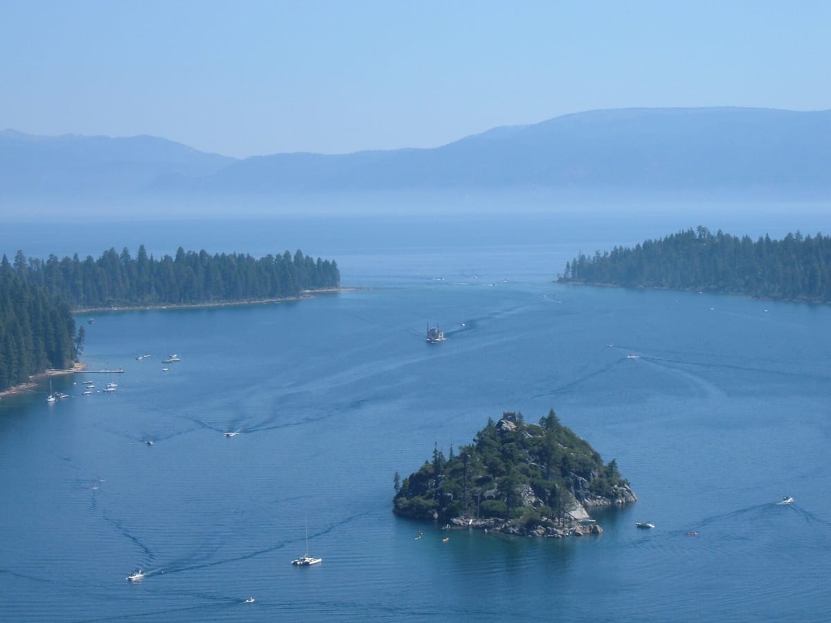
Iconic overlook of Emerald Bay and Fannette Island. Vikingsholm castle sits on the shore below.
- 3Destination
South Lake Tahoe
810 El Dorado Avenue, South Lake Tahoe, California 96150, United States
Largest town on the lake, at the California–Nevada line.
About this drive
California Highway 89 along Lake Tahoe's west shore links Tahoe City and South Lake Tahoe, passing through pine forest, lakeside villages and state parks. The highlight is Emerald Bay, where the road climbs onto a narrow granite ridge with drops on both sides, giving views down to Fannette Island and the blue-green water of the bay. In summer, parking at the Emerald Bay overlooks fills early. In winter, the section around Emerald Bay can close for avalanche control. Continue on around the lake via the Nevada side for a full 72-mile loop. Cover photo: "Paddleboat in Emerald Bay" by Christopher Eugene Lee, CC BY-SA 4.0, via Wikimedia Commons (https://commons.wikimedia.org/wiki/File:Paddleboat_in_Emerald_Bay.jpg).
Photos & videos
(0)Discussion
Know a great drive?
Help us build the most thoughtfully curated road map in the country. Map it and share it — our team reviews every drive.
Add a drive